Last updated on August 4th, 2026 at 09:48 am
Hampta Pass is roughly 16-18 km from Manali by road and about 26-30 km on foot. By car, you drive from Manali to Jobra base camp (2,800m), which takes around 1.5 to 2 hours thanks to 40+ hairpin bends on a mountain road. From Jobra, the actual trek to Hampta Pass begins.
So when people ask “how far is Hampta Pass from Manali,” there are two distances that matter. The road gets you to the start. The trek does the rest.
The pass sits at 14,107 ft (4,300m) above sea level. It connects the lush Kullu Valley to the dry, cold Lahaul Valley. Most trekkers complete the full route over 4-5 days.
The best time to do this trek in 2026 is mid-June to September. Outside that window, snow blocks the trail and makes crossing the pass dangerous.
This guide covers everything: the route, campsites, distances, and tips for 2026.
How to Reach Manali (The Starting Point)
A lot of trek guides jump straight to Day 1 and forget that half the planning headache is getting to Manali in the first place. Let me fix that.
By Air (Bhuntar Airport, Kullu)
The closest airport to Manali is Bhuntar Airport in Kullu, about 50 km from the town. Cab rides from the airport to Manali take roughly 1.5 to 2 hours depending on traffic at the Kullu market stretch.
The honest truth from my experience: I stopped booking flights to Bhuntar a long time ago. The airport operates on one of the most unreliable schedules in India. Fog, low cloud cover, strong Himalayan winds can ground every single flight for an entire day without warning. I have seen trekkers miss their trek start entirely because they were stuck at Delhi airport waiting for a weather window that never came. If you are on a tight schedule, do not depend on this route.
By Train (Joginder Nagar Railway Station)
The nearest railway station with regular connectivity is Joginder Nagar, about 160 km from Manali. From there, you are looking at a 4 to 5 hour cab or local bus ride to Manali through winding mountain roads. This route is perfectly fine if you are combining the trek with a broader Himachal trip, but it adds a full day of travel buffer you need to account for.
By Road (The Actual Best Option)
This is what most serious trekkers do, and for good reason.
| Starting Point | Drop Point | Distance | Travel Time |
| New Delhi | Manali Private Bus Stand | ~530 km | 12 to 14 hours |
| Chandigarh | Manali Private Bus Stand | ~300 km | 8 to 10 hours |
Take the overnight Volvo bus. Both Delhi and Chandigarh have regular Himachal Road Transport Corporation (HRTC) and private Volvo AC buses that leave in the evening and arrive in Manali by early morning. You sleep through most of the journey, arrive fresh, and save a full day of travel time. From Delhi, it is 12 to 14 hours. From Chandigarh, closer to 8 to 10.
I have done this route more times than I can count, and the overnight Volvo remains the most practical choice for anyone flying into Delhi or Chandigarh first. Book the seats above the wheel axle if you tend to feel bumps more, and avoid the very last rows at the back.
Hampta Pass Trek Distance Breakdown: Manali to Chandratal
Here is the full distance breakdown from Manali to Chandratal, so you know exactly what to expect each day.
| Point A | Point B | Distance | Time Taken | Mode |
| Manali (The Woodbine) | Jobra Base Camp | 16-18 km | 1.5 – 2 hrs | Drive |
| Jobra (2,800m) | Chika | ~4-5 km | 3 – 4 hrs | Trek |
| Chika | Balu Ka Ghera | ~8-9 km | 5 – 6 hrs | Trek |
| Balu Ka Ghera | Shea Goru | ~6-7 km | 5 – 6 hrs | Trek |
| Shea Goru | Hampta Pass (4,300m) | ~4-5 km | 3 – 4 hrs | Trek |
| Hampta Pass | Chatru | ~4-5 km | 3 – 4 hrs | Trek |
| Chatru | Chandratal | ~60 km | 2 – 3 hrs | Drive |
Total trekking distance: ~26-30 km over 4-5 days.
Why the Drive to Jobra Takes So Long
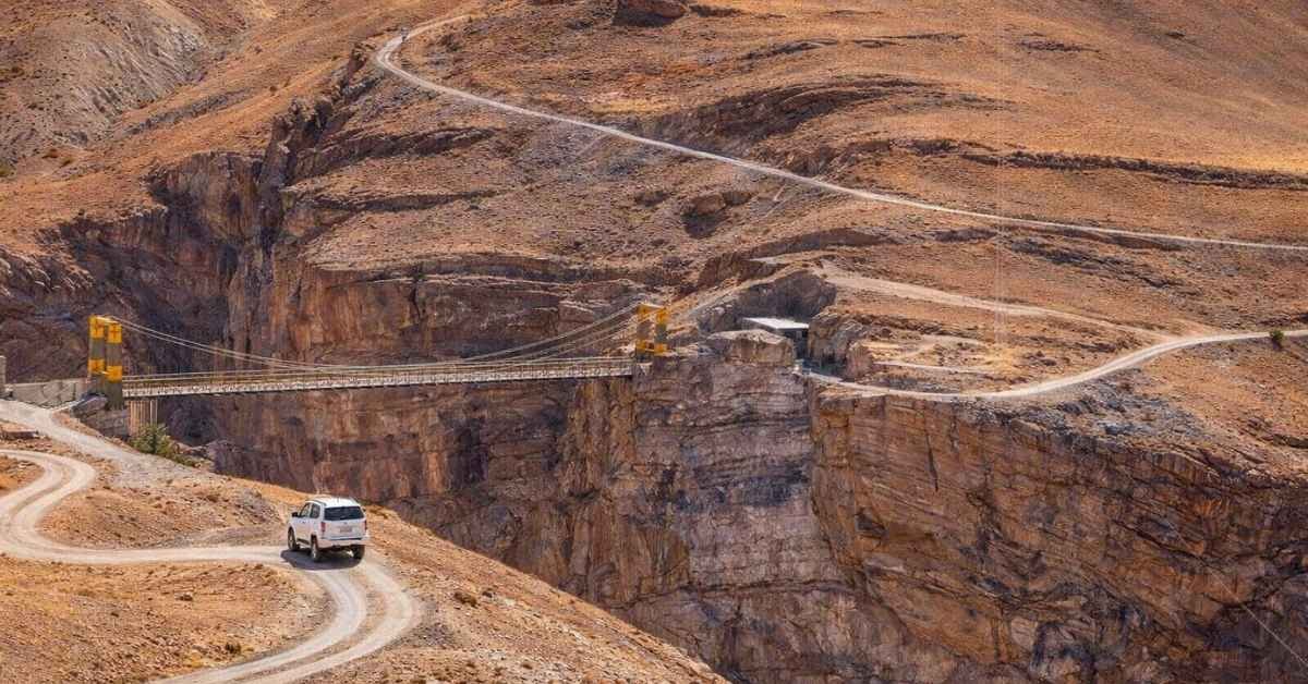
The road from Manali to Jobra is only 16-18 km, but do not let that fool you. The route has 40+ hairpin bends cutting through narrow mountain roads. One wrong turn and there is a steep drop on the side. Drivers slow down significantly at every bend.
Most operators pick up trekkers from The Woodbine hotel in Manali. This is the common reporting point before the drive to Jobra base camp begins.
Not Sure Where To Go!
Let our Random Country Generator help you discover your next perfect destination.
Use Our Free ToolWhy Hampta Pass is Called the “Crossover” Trek
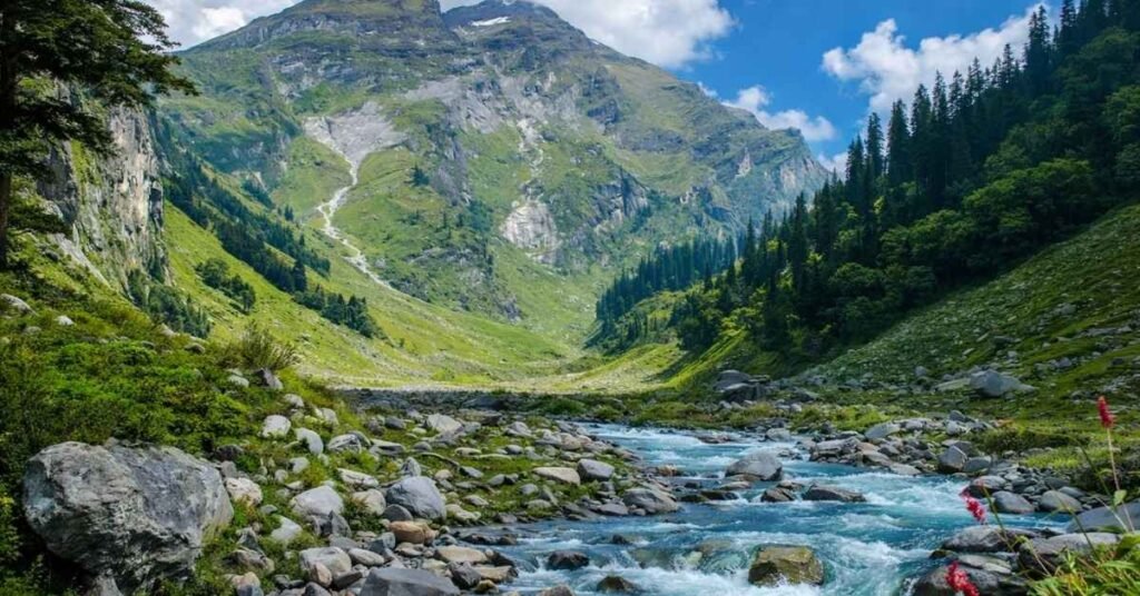
Most treks look the same throughout. Hampta Pass does not.
This trek is famous for one reason: the landscape changes completely as you cross the pass. No other trek near Manali gives you this contrast in just 4-5 days.
One Side: Green and Lush
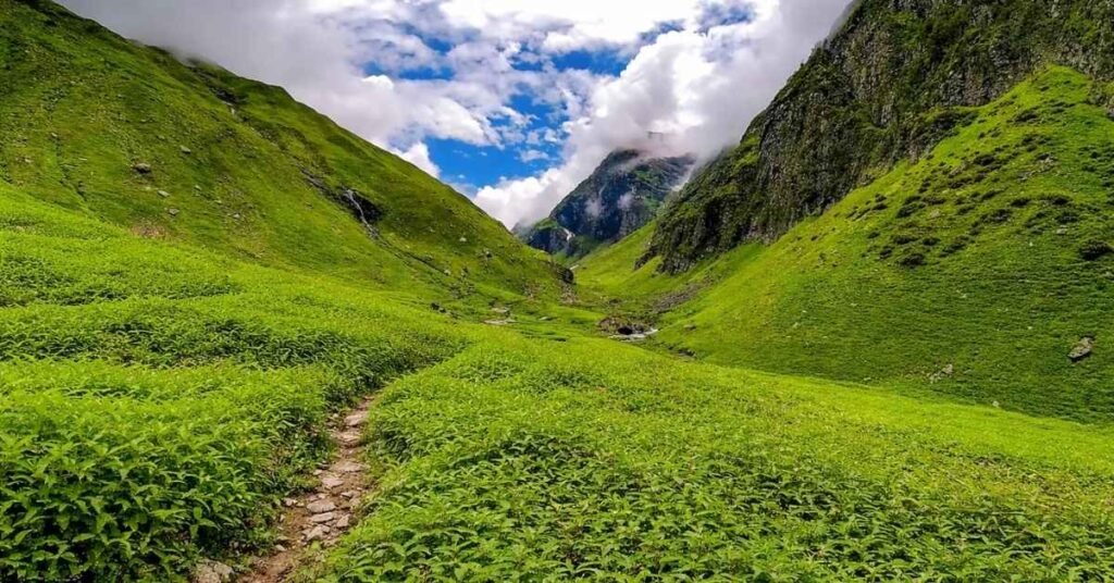
From Jobra to the pass, you walk through the Kullu Valley. The trail is surrounded by thick pine forests, wildflowers, and cold rivers. The air is cool and moist. Waterfalls run along the trail. It feels green everywhere you look.
Other Side: Dry and Dramatic
The moment you cross Hampta Pass at 14,107 ft (4,300m), everything changes. You step into the Lahaul Valley and the green vanishes. The land turns grey, brown, and rocky. It looks almost like a different planet. The air gets drier and the landscape opens up wide.
This single moment of crossing is why trekkers call it the “crossover” trek.
Mountain Views at the Top
Standing at the pass, you get clear views of Mt. Indrasan and Deo Tibba on a good day. Both are massive Himalayan peaks that tower over the Kullu Valley side. Trekkers stop here to take it all in before the descent to Shea Goru.
The pass itself is not a destination. The contrast on either side is.
Hampta Pass Trek: Day-Wise Itinerary for 2026
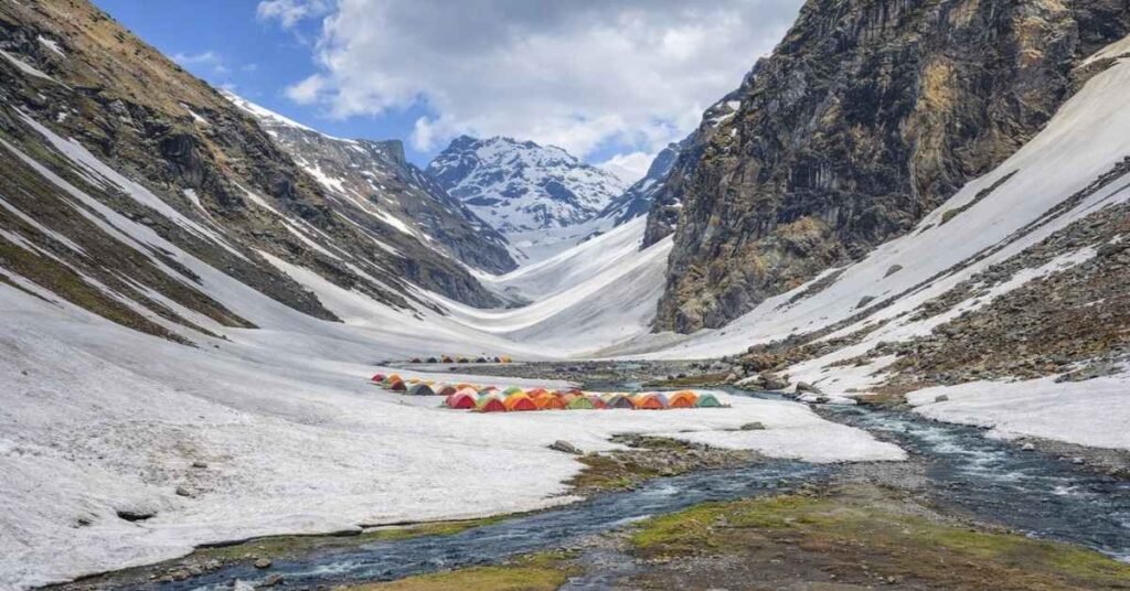
This is not a tourist brochure version. Here is what each day actually looks like on the ground.
Day 1: Manali to Jobra to Chika
Drive: Manali (The Woodbine) to Jobra Base Camp (2,800m) | 16-18 km | 1.5-2 hrs Trek: Jobra to Chika | ~4-5 km | 3-4 hrs Altitude Gain: ~400m Difficulty: Easy
The day starts early. Your operator picks you up from The Woodbine in Manali and drives you through 40+ hairpin bends to Jobra base camp at 2,800m. Once at Jobra, the trek begins.
The first stretch to Chika is a warm-up. The trail runs alongside the Rani Nala stream. The path is clear, the gradient is gentle, and the forest cover keeps it cool. You camp at Chika for the night. This is a good day to find your pace and break in your boots.
Day 2: Chika to Balu Ka Ghera
Trek: Chika to Balu Ka Ghera | ~8-9 km | 5-6 hrs Altitude Gain: ~700m Difficulty: Moderate
This is the longest day on the trail. The path follows the river for most of the route before opening into a wide sandy valley. Balu Ka Ghera translates to “home of sand” and that name fits. The campsite sits in a broad, open area surrounded by high peaks.
The trail crosses a few stream sections that can be knee-deep depending on snowmelt. Trekking poles help a lot on Day 2. Camp at Balu Ka Ghera and rest well. The hardest day comes next.
Day 3: Balu Ka Ghera to Shea Goru (via Hampta Pass)
Trek: Balu Ka Ghera to Hampta Pass to Shea Goru | ~10-12 km | 7-8 hrs Altitude Gain: ~900m to pass, then steep descent Difficulty: Hard
This is the biggest day of the trek and the one that separates Hampta Pass from easier trails.
The morning climb from Balu Ka Ghera to the pass at 14,107 ft (4,300m) is steep and relentless. Snow patches stay on this section well into July in 2026. The final push to the top demands slow, steady steps. Rushing at this altitude is a mistake.
At the top, you get the full crossover moment. Kullu Valley green behind you, Lahaul grey ahead. The views of Mt. Indrasan and Deo Tibba are best from here on a clear morning.
Then comes the descent to Shea Goru, and this is where most injuries happen. The trail down is steep, loose, and long. The ground shifts underfoot. Take your time on this section. Trekking poles are not optional here, they are necessary. Shea Goru is the coldest and most scenic campsite on the route. Nights here are sharp and clear.
Day 4: Shea Goru to Chatru
Trek: Shea Goru to Chatru | ~4-5 km | 3-4 hrs Altitude Loss: ~600m Difficulty: Easy to Moderate
A shorter day that gives your legs a break. The Lahaul Valley trail to Chatru is open and flat compared to the previous day. Chatru is a small roadhead where vehicles wait. Most operators drive from Chatru to Chandratal lake for camping.
Day 5: Chandratal and Return to Manali via Atal Tunnel
Chandratal Visit: 1-2 hrs at the lake Return Drive: Chatru to Manali via Atal Tunnel
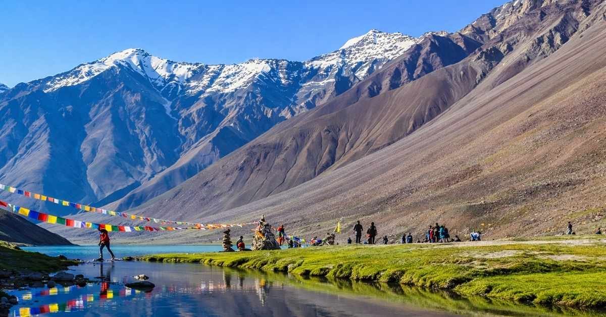
Chandratal, the Moon Lake, sits at high altitude and is the final highlight of the trek. The water shifts between blue and green depending on the light. Early morning visits before other tourists arrive are worth the effort.
The return to Manali in 2026 is faster than ever. The route via Atal Tunnel cuts 3-4 hours off the old Rohtang Pass road. The tunnel stays open in all weather conditions, which makes the return reliable even if the weather turns.
Expect to be back in Manali by evening on Day 5.
Best Time to Do Hampta Pass Trek in 2026
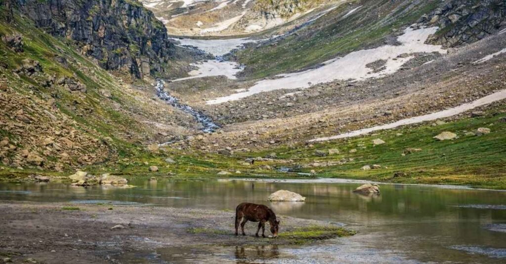
The trekking window for 2026 runs from mid-June to September. Each month feels different on the trail.
Mid-June: Snow Still on the Pass
The trek opens around mid-June but the pass at 14,107 ft (4,300m) still carries heavy snow. Stream crossings are deeper due to snowmelt. The trail to Balu Ka Ghera can be slippery in sections. This window suits experienced trekkers who are comfortable on snow. First-timers should wait until July.
July to August: Peak Season but Watch the Rain
July and August are the most popular months. The snow clears, the wildflowers bloom, and the green Kullu Valley side looks its best. However, this is also monsoon season in the hills.
Late July brings the highest risk of landslides on the Manali approach roads. The drive from Manali to Jobra uses narrow mountain roads with 40+ hairpin bends. A single landslide can block the route for hours or even a full day. Always check road conditions before you leave Manali.
September: The Best Month Overall
September is the sweet spot. The monsoon pulls back, skies clear up, and the views of Mt. Indrasan and Deo Tibba from the pass are sharpest this month. Temperatures drop at night, especially at Shea Goru, but daytime trekking is comfortable. Crowds thin out compared to July and August.
Hampta Pass Trek: Packing List and Cost Breakdown for 2026
Essential Gear Checklist
Clothing and Layers
- Thermal base layer (top and bottom)
- Fleece mid-layer
- Waterproof windcheater or rain jacket
- Warm gloves and a wool cap
Trek Gear
- Trekking poles (non-negotiable for Shea Goru descent)
- Microspikes or crampons for mid-June snow
- Sturdy trekking boots with ankle support
- Headlamp with spare batteries
Other Essentials
- Personal first aid kit
- Sunscreen SPF 50+
- Water purification tablets
- Dry bags for electronics
2026 Cost Breakdown
A fully organised Hampta Pass trek from Manali costs between ₹6,500 to ₹9,000 per person. This typically includes transport from The Woodbine, meals, tents, and a guide.
Mule Offloading: If carrying a heavy backpack is not your thing, mules are available on the trail to carry your bag. Budget an extra ₹300-500 per day for this service.
The Reality of Trekking 30 km at High Altitude (Difficulty & Fitness)
Here is a conversation I have had a dozen times at trek briefings: someone hears “30 km over 5 days” and thinks, “That is barely 6 km a day. I walk more than that in my city.”
No. Stop right there.
6 km on a flat Bengaluru road and 6 km on a Himalayan trail above 11,000 feet are two completely different physical experiences. Let me break down why.
The Drive to Jobra is the First Test
Before the trek even starts, you will face 40+ sharp hairpin bends on the 16 to 18 km drive from Manali to Jobra base camp. The road is narrow, the drops are serious, and the vehicle sways constantly. In my experience, a decent chunk of the group is already motion-sick by the time they reach Jobra.
Pro tip: Take your anti-nausea medicine (avomine or meclizine work well) at least half an hour before you leave The Woodbine Hotel or your Manali guesthouse. Do not wait until you feel the nausea creeping in on the third switchback. By then it is too late and you will spend the first hour of your trek recovering instead of absorbing the landscape.
The Terrain Is Unforgiving
Once you are on trail, here is what you are actually dealing with:
Boulders and rocky paths: The section from Chika to Balu Ka Ghera involves constant scrambling over loose rock. There is no rhythm to your footing. Your ankles, knees, and hips are working three times harder than they would on a flat trail.
Glacial stream crossings: Between Chika and Balu Ka Ghera, you will cross 2 to 3 major glacial streams, sometimes thigh-deep. I still remember the first time I waded into one of those streams near Balu Ka Ghera. The cold hits you before the water even reaches your knees. It is the kind of cold that makes your legs seize for a second. Trekking poles are not optional here, they are essential for balance.
Loose scree on the descent: The descent from Hampta Pass down into Shea Goru is on loose scree fields. Your knees take a beating going down. This is where trekkers with zero quad strength really start to suffer.
Snow patches at the pass: Even in mid-June, the area around the 14,107-foot summit holds snow. Microspikes or gaiters can save you from an ugly slip.
Fitness Baseline
You do not need to be an ultra-marathon runner, but you should be able to walk 8 to 10 km on flat ground without stopping. Start stair training 6 weeks before the trek. Your knees will thank you on the descent.
The Return Drive Distance (Chatru to Manali via Atal Tunnel)
After four days on rock, scree, glacial rivers, and a tent floor, the return drive from Chatru to Manali hits differently.
The Route
Chatru → Gramphu → Sissu → North Portal → Atal Tunnel → South Portal → Manali
Total distance: approximately 64 km. Expect the drive to take 3.5 to 4 hours, depending on the road conditions between Chatru and Gramphu, which can be rough and sometimes waterlogged after rainfall.
The Old Route vs. The 2026 Route
Anyone who did this trek before 2020 will remember the return via Rohtang Pass, a high-altitude road that crossed over 13,058 feet, was perpetually congested with tourists, and could be completely closed by afternoon snowfall with zero warning. It added 3 to 4 extra hours to the return and required permits that were often a logistical headache.
That route is now largely irrelevant for trekkers. The Atal Tunnel, inaugurated in 2020, changed the return journey entirely.
| Route | Distance | Time | Reliability |
| Old Rohtang Pass Route | Longer, unpaved sections | 6 to 7 hours | Highly weather dependent |
| Current Atal Tunnel Route | ~64 km | 3.5 to 4 hours | All-weather, year-round |
The tunnel is 9.02 km long, cuts straight through the Pir Panjal range, and connects Sissu in the Lahaul Valley to the south portal near Solang Valley. It single-handedly makes the Hampta Pass trek far more logistically predictable.
The Moment You Enter the Tunnel
I will be honest about what that moment feels like after four days on the trail. You have been walking on rocks, sleeping in a tent, and eating daal-rice at a dhaba in Chatru. Your boots are caked in dried mud. Your legs feel like someone replaced your muscles with wet cement.
And then you pull off the rough Chatru road and onto smooth, modern asphalt. The road surface is so clean it almost feels strange. You enter the Atal Tunnel and there is a particular relief that washes over you, the kind that comes from knowing you are heading back to hot water, a real bed, and mobile network. That 9 km of tunnel might be the most satisfying 9 km of the entire trip.
FAQs
Do I need a permit?
No special permit is required for Hampta Pass trek as of 2026. Your trek operator handles all forest entry formalities.
Is it beginner-friendly?
Partially. Day 1 and Day 2 are manageable for fit beginners. Day 3, the Shea Goru descent from 14,107 ft (4,300m), is tough and needs prior trekking experience.
Is there mobile network on the trail?
No. Network cuts out after Jobra base camp. Download offline maps before you leave Manali.
Ready to Trek Hampta Pass in 2026?
The distance from Manali to Hampta Pass is 16-18 km by road and 26-30 km on foot. Now you have everything to plan it right. Book early for the September window, it fills up fast.