Last updated on August 9th, 2026 at 07:57 am
| Trek Segment | Distance | Estimated Time | Difficulty |
| Chopta to Tungnath | 3.5 km | 2 to 2.5 hours | Moderate |
| Tungnath to Chandrashila | 1.5 km | 1 to 1.5 hours | Steep and Hard |
| Total One Way | 5 km | 3 to 4 hours | Moderate to Hard |
| Total Return | 10 km | 6 to 7 hours | Moderate to Hard |
The trail changes a lot as you go higher. Here is what to expect on each part:
- Chopta to Tungnath: The path is wide and well-marked. It has stone steps for most of the way. Trees cover the trail, so it feels cool even on sunny days.
- Tungnath to Chandrashila: This is the hardest part. The path gets very steep. The air is thin at this height, so your lungs have to work harder. Take small steps and go slow.
- Total Distance: 5 km one way is not too long. But the high altitude makes it feel much harder than a normal 5 km walk.
- Return Trek: Going down is faster. Most people finish the return in 3 to 3.5 hours.
Phase 1: Chopta to Tungnath Trek
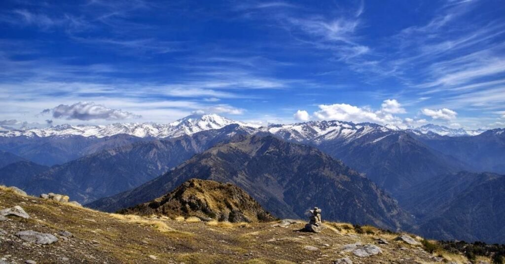
The first leg of the trek covers 3.5 km. It starts from Chopta at 2,680m and takes you up to Tungnath Temple at 3,680m. That is a climb of 1,000m in altitude.
This section takes around 2 to 2.5 hours for most people.
The trail is well-built. Large stone steps cover most of the path. You will not need any special gear or climbing skills for this part.
Key highlights of this phase:
- Stone paved trail: The path has proper steps cut into the mountain. It is easy to follow and hard to get lost.
- Forest cover: The lower section passes through dense Rhododendron and Oak trees. It keeps the trail cool and shaded.
- Steady incline: The climb is gradual. It gets steeper only closer to the temple.
- Small dhabas on the way: Local tea stalls operate along the trail during the season. You can stop for tea, snacks, and rest.
- Tungnath Temple: You arrive here at 3,680m. This is the highest Shiva temple in the world. The stone temple is ancient and sits in an open alpine meadow.
Reach Tungnath and take a proper break. Spend at least 20 to 30 minutes here. Drink water, eat something light, and let your body adjust to the altitude.
The second leg to Chandrashila starts right behind the temple. It is shorter but much harder.
Phase 2: Tungnath to Chandrashila Trek Distance & Route
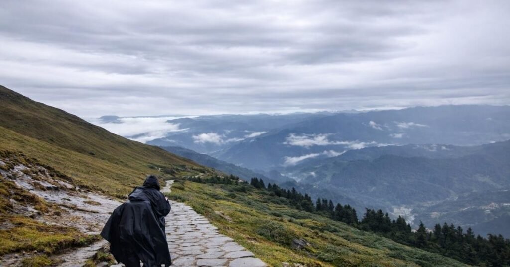
The second leg is only 1.5 km. But do not let that small number fool you.
This short stretch takes 1 to 1.5 hours to complete. It is the hardest part of the entire trek.
Why is 1.5 km so difficult here?
The trail goes straight up. There are no gradual switchbacks like the first leg. Every step pushes you higher at a fast rate.
At this altitude, the air has much less oxygen. Your body works harder just to breathe. Most trekkers have to stop every few minutes to catch their breath. That is completely normal.
You start at 3,680m at Tungnath Temple. You finish at 4,000m at Chandrashila Peak. That is a 320m altitude gain in just 1.5 km.
What to expect on this stretch:
- The path is rocky and uneven in several places
- Wind gets very strong as you go higher
- Temperature drops fast near the summit
- The trail is exposed with no tree cover at all
- Your legs will feel heavy due to thin air
At the Chandrashila Summit:
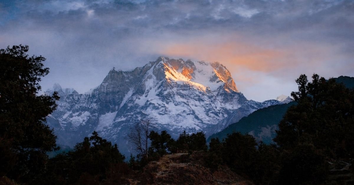
The effort is worth every hard step. From 4,000m, you get a full 360-degree view of the Himalayas. On a clear day, you can see Nanda Devi, Trishul, Kedarnath Peak, and Bandarpoonch.
Go slow. Drink water often. Do not rush this section. Altitude sickness can hit fast if you push too hard.
Not Sure Where To Go!
Let our Random Country Generator help you discover your next perfect destination.
Use Our Free ToolHow to Reach Chopta (The Basecamp)
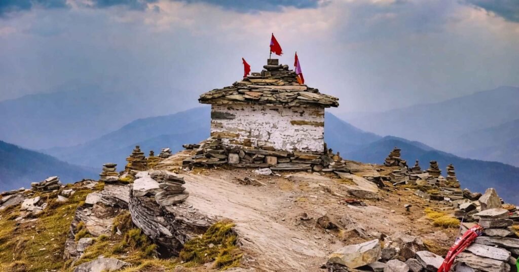
Chopta is the starting point for the Tungnath Chandrashila trek. It is a small roadside stop in Uttarakhand. There are no trains or flights to Chopta. You have to reach here by road.
Distances from major cities to Chopta:
- Rishikesh to Chopta: 202 km, around 7 to 8 hours by road
- Dehradun to Chopta: 226 km, around 8 to 9 hours by road
- Haridwar to Chopta: 220 km, around 8 to 9 hours by road
- Delhi to Chopta: 450 km, around 13 to 14 hours by road
Step by step route from Rishikesh:
Rishikesh is the most common starting point for most trekkers.
- Take the road towards Devprayag, then Rudraprayag
- From Rudraprayag, head towards Ukhimath
- Ukhimath is the last major town before Chopta
- From Ukhimath, Chopta is only 40 km away
- The road from Ukhimath to Chopta passes through thick forests and mountain curves
How to get to Chopta:
- By shared jeep: Available from Rishikesh and Ukhimath. Cheapest option.
- By private taxi: Book from Rishikesh or Dehradun for direct and comfortable travel.
- By bus: State buses run up to Ukhimath. From there, take a local jeep to Chopta.
Reach Chopta a day before your trek. This gives your body time to adjust to the altitude before the climb.
Best Time for the Trek
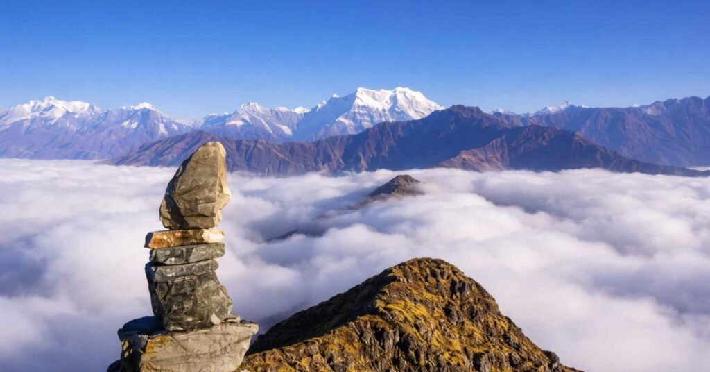
The trek stays open for two main seasons every year.
Summer Season: April to June
- Snow starts melting in April. The trail becomes walkable.
- Rhododendron flowers bloom across the hillsides in April and May.
- Days are clear and weather is stable. Best for views from Chandrashila.
- Avoid late June as monsoon clouds start rolling in.
Autumn Season: September to November
- Monsoon ends by mid-September. The trail dries up quickly.
- October is the best single month for crystal clear Himalayan views.
- November gets very cold. Snow can appear on the Chandrashila summit.
- The trek closes for winter after mid-November.
Avoid: July and August. Heavy rain makes the trail slippery and dangerous.
Trek Difficulty Level
This trek is rated moderate to difficult overall.
The Chopta to Tungnath section is manageable for most people with basic fitness. The Tungnath to Chandrashila section is genuinely hard because of the steep climb and thin air at 4,000m.
Fitness checklist before you go:
- You can walk 8 to 10 km without stopping
- You have no serious heart or lung conditions
- You have done light exercise in the weeks before the trek
About altitude sickness: It can hit anyone above 3,000m. Headache, dizziness, and nausea are the early signs. If symptoms appear, go down immediately. Do not push through it.
Top Attractions Near the Chopta Basecamp
Chopta works as an excellent anchor for a longer Uttarakhand itinerary. The surrounding region has several worthwhile stops that turn a 2-day trek into a meaningful 5 to 6 day hill journey.
| Attraction | Distance from Chopta | Key Highlight |
| Ukhimath | 40 km | Winter seat of Lord Kedarnath and Omkareshwar Temple |
| Kedarnath Wildlife Sanctuary | Surrounding area | Rich biodiversity, dense oak forests, Himalayan wildlife |
| Makku Math | 24 km | Winter seat of Lord Tungnath (visited November to April) |
Ukhimath
Located 40 km from Chopta, Ukhimath carries significant religious and cultural weight in the Garhwal Himalaya. This is where the idol of Lord Kedarnath is ceremonially brought every winter when the main Kedarnath temple closes. The Omkareshwar Temple here is the centrepiece of the town’s religious calendar.
For anyone traveling outside of peak summer season, Ukhimath offers a quieter, more intimate encounter with the Kedarnath deity than the main shrine ever could.
Kedarnath Wildlife Sanctuary
The sanctuary is not a separate destination you drive to. It is the living landscape surrounding the entire Chopta trekking zone. Dense oak, rhododendron, and bugyals (alpine meadows) form the core of the habitat.
For nature-focused travelers, this sanctuary rewards slow movement and early mornings. The Himalayan Monal, Uttarakhand’s state bird and one of the most visually striking pheasants in the Himalaya, is regularly spotted along the forest sections of the trail.
Makku Math
For winter trekkers visiting between November and April when Tungnath temple doors remain closed, Makku Math at 24 km from Chopta holds special significance. This is the temporary winter home of Lord Tungnath’s idol during the closure period.
Visiting Makku Math during these months provides a connection to the religious tradition of the shrine even when the high-altitude temple itself is inaccessible for worship.
Winter Trekking & Essential Forest Permits
The single most repeated misconception about this trek is that it closes in winter. That is factually wrong, and it stops people from experiencing one of India’s finest snow treks.
Here is the accurate picture: the Tungnath temple doors (kapat) close between November and April. The idol is relocated to Makku Math during this period. The trail, however, does not close with the temple. The Chandrashila trek remains open 365 days a year and is consistently ranked among India’s most rewarding winter trekking routes.
What Winter Actually Looks Like on Trail
From December through March, the route above Chopta fills with heavy snowfall. The stone steps leading up to Tungnath disappear under a meter or more of packed snow, and the summit zone becomes a proper alpine winter environment.
Two pieces of gear become non-negotiable in these conditions. Micro-spikes for traction on icy sections, and gaiters to keep snow out of your boots on the deeper drifts above treeline. Without them, the descent from Chandrashila can become genuinely hazardous.
The Kedarnath Wildlife Sanctuary Permit
The Chopta to Chandrashila trail passes through the Kedarnath Wildlife Sanctuary, which means a forest permit is legally required before you start walking.
The process is straightforward. You collect the permit at the Forest Department check post at Chopta. If you are starting your circuit from Sari village, the permit is available there as well. The sanctuary covers a rich stretch of biodiversity, home to the Himalayan Monal (Uttarakhand’s state bird), musk deer, and red fox. The permit system exists to protect exactly this ecosystem, and compliance is both legally mandatory and ecologically important.
Pro Tips from the Trail: My Personal Experience
These are not generic reminders you will find on every trekking website. These are the specific things I wish someone had told me clearly before my first Chandrashila summit attempt.
Start the Final Push Before Sunrise
The last 1.5 km from Tungnath temple to the Chandrashila summit needs to begin at 4:00 AM. That is not a suggestion. That is the window that gets you to the top by 5:30 AM for sunrise.
By mid-morning, cloud cover builds rapidly at this altitude. The 360-degree panoramic view of Nanda Devi, Trishul, Kedarnath, Chaukhamba, and Bandarpunch that makes this summit famous can vanish behind cloud within minutes. The 4:00 AM start is what separates trekkers who see it from those who don’t.
The Wind Chill Gap Is Brutal
At 4,000 meters, the number on your thermometer is not the temperature your body experiences. On a typical winter morning, the air temperature might read 2 degrees Celsius. But with 30 km/h winds, which are completely normal at the summit ridge, the wind chill brings the felt temperature down to roughly -5 degrees Celsius.
That 7-degree gap does not sound dramatic on paper. On the ridge, exposed and sweating from the climb, it feels catastrophic if you are underprepared. A wind-proof outer shell and thermal liner gloves are non-negotiable above Tungnath, regardless of what the forecast says.
Drink Water Before Your Body Asks for It
High altitude cold air aggressively suppresses the thirst mechanism. Your body is losing water through respiration and exertion at a much higher rate than at sea level, but your brain will not send the usual thirst signal to warn you.
The rule I follow on every high-altitude trail: take a deliberate sip of water every 15 minutes, no matter how I feel. Dehydration at altitude accelerates altitude sickness symptoms faster than almost anything else. By the time you feel thirsty above 3,000 meters, you are already behind.
Essential Things to Carry
Keep your bag light. Every extra kilo feels heavier at high altitude.
Quick packing checklist:
- Water: Carry at least 2 liters. No reliable water source on the Tungnath to Chandrashila stretch.
- Trekking shoes: Proper grip is important. The rocky trail near Chandrashila can be slippery.
- Warm layers: Temperature drops fast above 3,500m. Carry a fleece jacket and a windproof outer layer.
- Snacks: Energy bars, dry fruits, and biscuits keep your energy up between stops.
- Sunscreen and sunglasses: UV exposure is very strong at 4,000m. Do not skip these.
- Basic first aid: Include altitude sickness tablets like Diamox if your doctor approves.
Final Thoughts
The total trek distance is 5 km one way. That is not a big number on paper.
But this trail climbs from 2,680m to 4,000m. The thin air, steep sections, and cold winds make every kilometer count.
The 1.5 km from Tungnath to Chandrashila is the hardest stretch. It is also the most rewarding. Standing at 4,000m with the entire Himalayan range in front of you makes the burning legs and heavy breathing completely worth it.
Start early, go slow, and carry enough water. This trek delivers every time.
Frequently Asked Questions
Is a guide mandatory for the Chopta to Chandrashila trek?
No, a guide is not legally mandatory for the direct Chopta to Chandrashila route. The trail is well-marked and straightforward in summer and autumn conditions. A guide becomes highly recommended, however, during winter months when heavy snowfall covers trail markers and route-finding becomes genuinely difficult.
Is this trek safe for absolute beginners?
Yes, it is classified as an entry-level Himalayan trek and is considered safe for first-time trekkers with basic fitness. The one demanding section is the final 1.5 km above Tungnath temple, which requires good cardiovascular stamina due to the altitude and gradient. Building aerobic fitness before the trip makes a significant difference here.
What is the mobile network situation on the trail?
Network connectivity is unreliable throughout. Jio and BSNL provide patchy, intermittent reception at Chopta basecamp. On the actual trail from Chopta to Chandrashila, there is zero reliable network coverage. Download offline maps before you begin and inform your contacts that you will be unreachable for the duration of the summit day.